
Just launched, and as promised... Wave, Wind, and Station Maps made Awesome!
Surf Captain Maps allow you to visualize the swell and wind data in a geographic interface. For users, who like to look at the data and understand where the swell and wind systems are coming from, the map resources are an extremely valuable resource.
Wave Maps. The Wave Maps are a spatial representation of the open ocean significant wave height (highest 1/3 of all wave heights). Scrolling through the timeline, you can view the change in wave heights over time, which gives you a better idea of the storm systems that are generating the swells at your break. For example, if the forecast is showing a South swell of 3ft @ 11 seconds, you can visualize where this swell is coming from on the map. In the wave map animation below, you will notice a large storm in the South Pacific sending waves towards the West Coast of South and Central America.
Wind Maps. The wind maps show wind speed (colored contours) and direction (arrows) for both the GFS and NAM weather models. The Surf Captain wind forecasts use both of these sources, and it's often useful to view the GFS and NAM forecasts distinctly to view their differences. Additionally, when you can view how the wind forecasts change over time spatially, you can understand the potential for small changes in the weather systems to affect the wind forecast at your break.
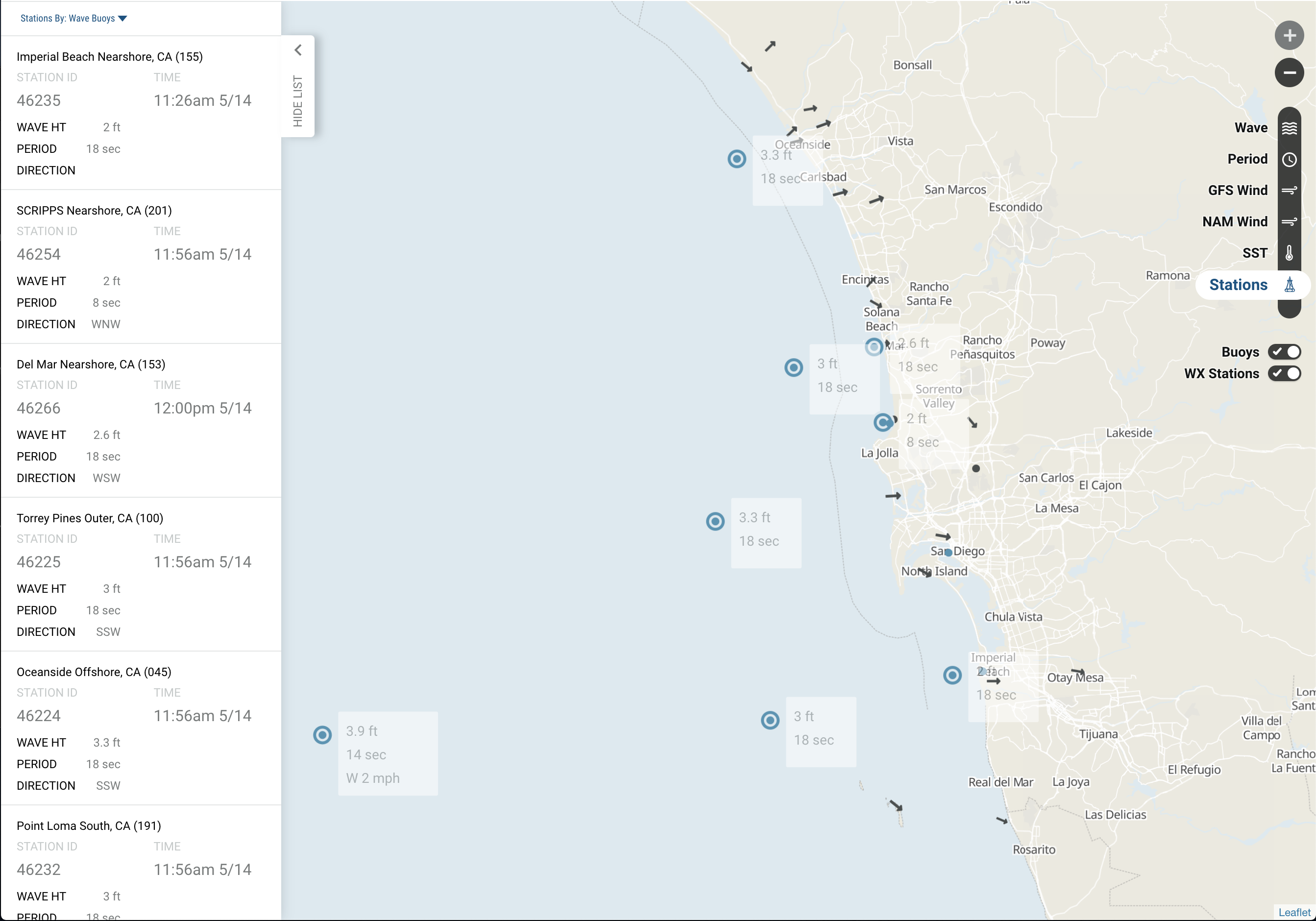
Station Map. The station data map allows viewing all of the coastal weather station and buoys in an easy to view interface. The forecast location page shows the current wind and buoy data, but the station map allows easy viewing of all the stations in a surrounding area. A nearby station may show east wind at one location, while 5 miles down the way, the wind could be west. It's super easy to view these spatial changes using the Station Map. Additionally, viewing the buoy data in a spatial interface, allows interpretation of upcoming changes in a swell. Click/touch a station to view more details of of the weather or buoy station.
We've also added maps for Wave Period and Sea Surface Temperature (SST).
We are really proud to release the Surf Captain maps to the world and hope they will up your game when it comes to your personal forecasting knowledge. We would love to hear how you like the Surf Captain maps, so please drop us a line.