
Our goal at Surf Captain is to make the forecast easy to understand at a glance, but to get a full grasp of the forecast for your local area it is a good idea to get an understanding of what is involved with forecasting the surf clean, fair, or choppy.
Let's start off with the some basic concepts.
Wind creates waves. There are 3 dimensions to the wind which will increase the wave height: wind speed, wind fetch (distance over which the wind blows), and wind duration. As each one of these dimensions increase, so do the wave heights. While wind is our friend when it comes to generating swell off the coast, a stiff wind along the shore has the opportunity to create localized wind chop and poor surfing conditions. The less wind chop at your local area, the cleaner (and generally better) the condition's will be.
How do we determine, how much wind chop there will be?
In Meteorology we describe wind from where it is coming from. An offshore wind means it is coming from the shore to the sea, and an onshore wind is coming form the sea to the shore. Since, most surf breaks are not far from the coastline, then there is very little distance between the land and the breaking waves. This is why an offshore wind will provide the cleanest conditions, because the fetch opportunity to create wind chop is so small. Additionally, an offshore wind can hold the breaking wave face up, potentially providing bigger and hollower surf. An onshore wind has a much larger distance to blow over to create wind chop towards your surf spot.
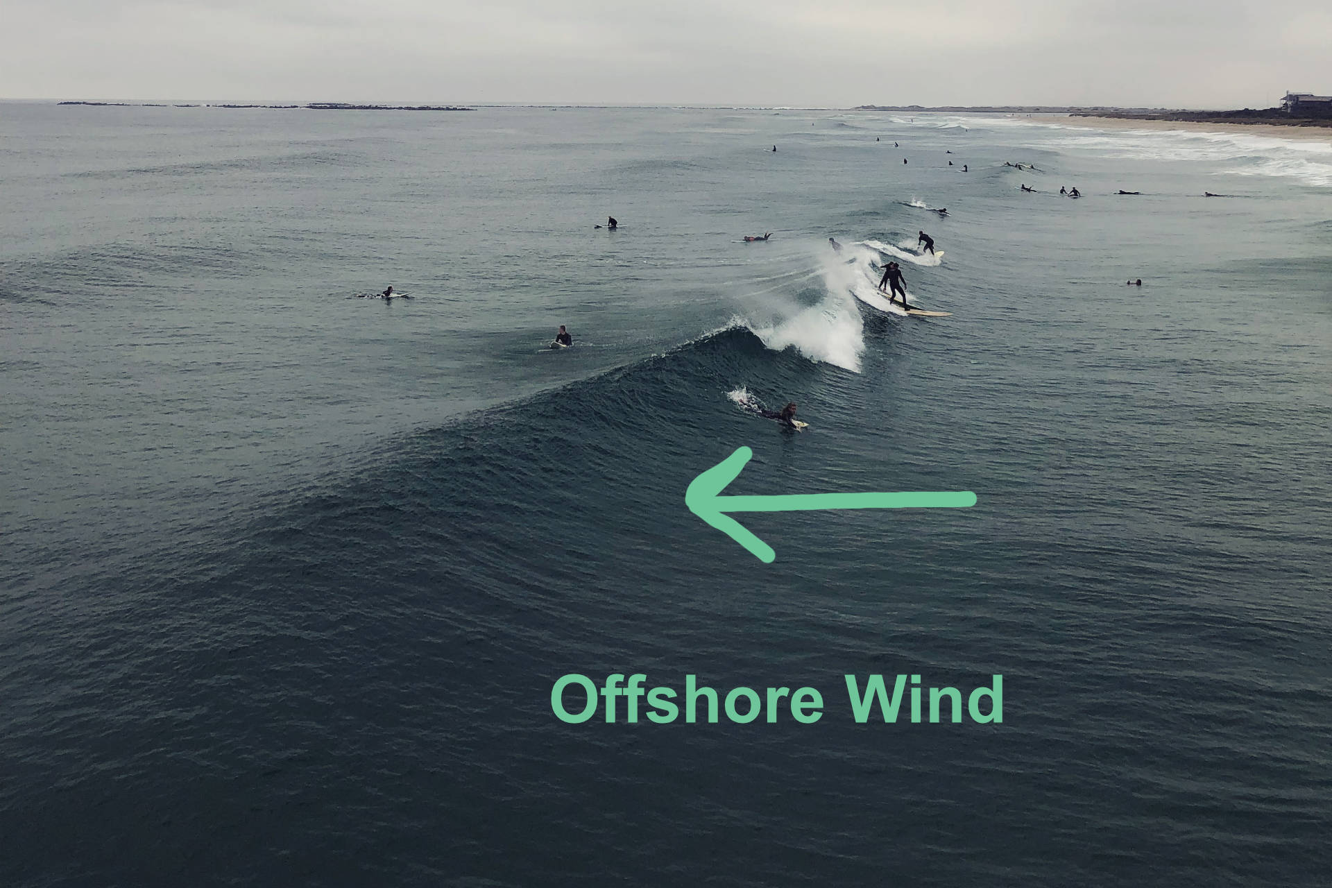
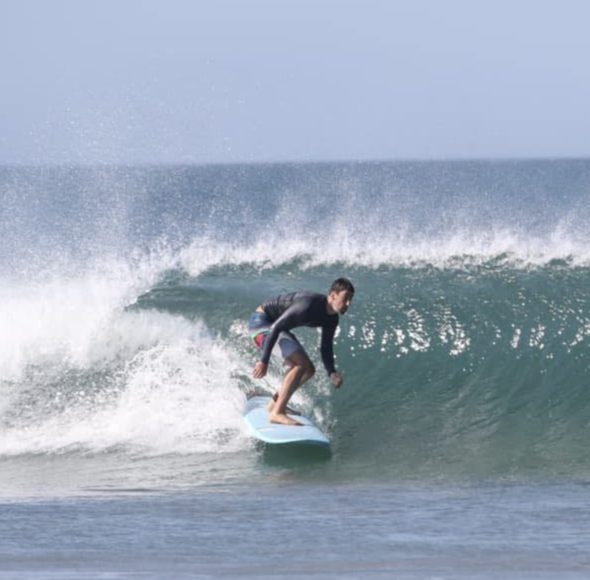
Offshore Wind, Clean Conditions
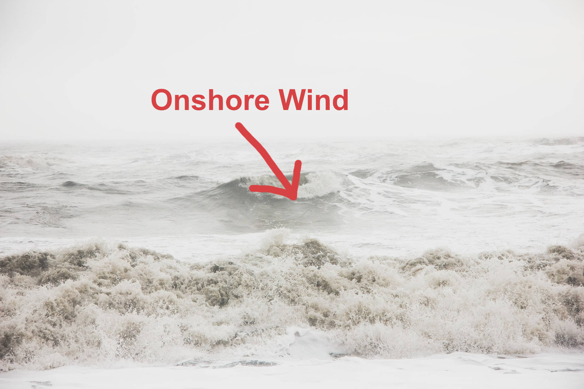
Onshore Wind, Choppy Conditions
Trickier concepts.
Okay, so offshore wind is more conducive for clean conditions, and onshore wind for choppy surf. What about everything in between. Often times, the side-shore wind (parallel to the coast), creates the worst conditions, because the wind chop is going sideways across the breaking waves. In contrast, when the wind is directly onshore, then the wind chop goes in the same direction as the breaking waves, which can often create fair conditions as long as the onshore wind is not too strong.
You'll notice that a light 5-10mph onshore wind will often produce fairly clean conditions. In contrast, a 30+mph direct offshore wind, will generally be strong enough to create some wind chop moving towards the breaking wave as well as creating a challenge paddling into such strong wind. It's also worth noting that a light 3-5mph wind should be mostly clean no matter what the wind direction is. Fortunately, Surf Captain does all these calculations for you.
How do we nail down the wind forecast?
Understanding how wind speed and wind direction will influence the conditions is paramount, but forecasting the wind is an entirely different problem. At Surf Captain, we know the beach facing directions for all of our forecast location regions, and also if there are any headlands or variation in the coastlines to account for a range of offshore wind directions. At the bottom of each Surf Captain forecast page, we note the offshore beach direction for that location.
Surf Captain uses multiple sources of NOAA wind forecast data, which are combined using our proprietary approach that has been refined over many years. There is a global forecast model, called the GFS, which we rely on for large scale weather systems and long range forecasts. There is also a mesoscale (intermediate size) weather model that covers the United States, called the NAM. The NAM is a higher resolution model and does a better job predicting local winds that are away from large storm systems. Unfortunately the NAM forecast only goes out to 60 hours in the future.
Wind forecasts can be challenging.
There are 2 main scenarios to account for challenges in predicting winds. Scenario 1 is when a low pressure storm system is moving very close to your location. The winds rotate tightly around the low pressure system, so any small shift in the forecast track can significantly change the wind forecast. It is important to be prudent in tracking these close moving storm systems, especially when you are more than 3 days out in the forecast timeline, where accuracy is reduced. It is not uncommon for the forecast to change often with these close moving storm systems.
In scenario 2, the challenge is accurately predicting land/sea breezes. A land breeze occurs when the land is much cooler than the ocean, and a local micro-scale convection process creates an offshore wind. In contrast, when the land heats up more than the nearby water (a common occurrence during hot summer days), a localized onshore sea breeze occurs. The regional weather model (NAM) does a decent job at predicting the land/sea breezes, but far from perfect, while the global weather model (GFS) is not able to capture these micro-scale process very well due to the lower resolution of the model. Since, the NAM model only goes out 60 hours in time, the long range forecasts will often lack accuracy to capture land/sea breezes. Surf Captain has its own land/sea breeze algorithm that we apply, but there is certainly still room for improvement in capturing this localized phenomena.
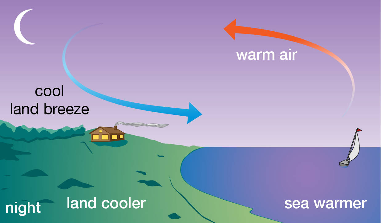
Land breezes from cooler land temperatures
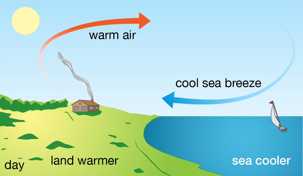
Sea breezes from hotter land temperatures
We hope this overview helps give you a better grasp of interpreting the forecast, and you can apply it to score your next good surf session.